



 Ha Giang
Lo Lo Chai Village: Culture, Homestays and How to Visit
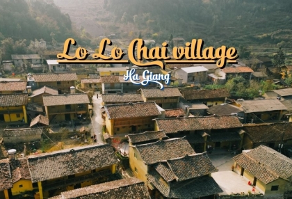
Lo Lo Chai Village near Lung Cu Flag Tower, a UN Tourism Best Tourism Village 2025, with Lo Lo culture, earthen homestays and Ha Giang Loop access.
Ha Giang is one of the most spectacular mountain destinations in northern Vietnam, known for winding roads, limestone peaks, deep valleys, ethnic villages and the famous Ha Giang Loop. The region is especially popular with travelers who want to explore Vietnam beyond the main tourist cities.
The highlight of a trip is usually the Ha Giang Loop, a multi-day road trip through Quan Ba, Yen Minh, Dong Van and Meo Vac before returning to Ha Giang. Along the way, travelers can ride across the Dong Van Karst Plateau, cross Ma Pi Leng Pass, take a boat on the Nho Que River and visit Lung Cu Flag Tower.
Where is Ha Giang in Vietnam? Ha Giang is in the far north of Vietnam, close to the Chinese border and about 300 to 320 km from Hanoi. Published distances differ slightly depending on the road taken, with figures of around 318 km and around 320 km both in common use. The destination is part of Vietnam's northern highlands, with high mountains, valleys, rivers and limestone landscapes.
On a Ha Giang Vietnam map, the main travel area is easy to understand. Ha Giang City is the usual starting point, while the most famous mountain landscapes lie farther north around Quan Ba, Yen Minh, Dong Van and Meo Vac.
A useful Ha Giang map for travelers should therefore cover two things: the road running north from Ha Giang City toward the border area, and the cluster of mountain attractions around Dong Van and Meo Vac. The full route is set out in the Ha Giang Loop map section below.
Whichever version of the map is used, the exact itinerary can change depending on weather, road conditions and the places included in the trip.
What province is Ha Giang in? Since Vietnam's 2025 administrative reorganization, the former Ha Giang Province was merged with Tuyen Quang Province to form the new Tuyen Quang Province. The former Ha Giang area remains the destination commonly known as Ha Giang for tourism purposes. The former Ha Giang City area was also reorganized into Ha Giang 1 and Ha Giang 2 wards.
Ha Giang can be visited throughout the year, but the scenery changes significantly by season.
March to May brings mild weather, spring flowers and increasingly green landscapes. April and May are also associated with the water season in some rice-growing areas. September to November is another popular period, with cooler weather, rice terraces and buckwheat flowers. Spring and autumn are the two periods most often recommended overall, while September and October are associated with the rice terraces and October to December with the buckwheat flowers.
For travelers planning the Loop, Ha Giang weather matters more than simply choosing a month. Mountain conditions can be cooler and wetter than in Ha Giang City, especially at higher elevations.
The Ha Giang Loop is a multi-day road trip through the mountains of northern Vietnam. The classic route starts and finishes in Ha Giang and passes through Quan Ba, Yen Minh, Dong Van and Meo Vac. The Vietnam National Authority of Tourism describes the Loop as a roughly 350 km route beginning at Km 0 in Ha Giang City and returning to the same starting area.
For travelers searching for a Ha Giang loop map, the classic route can be simplified as:
Ha Giang City - Quan Ba - Yen Minh - Dong Van - Ma Pi Leng Pass - Meo Vac - Du Gia - Ha Giang City
A 3 day Ha Giang Loop map normally covers the main route more quickly, while a 4 day Ha Giang Loop map allows more time for viewpoints, villages, short walks and local experiences.
There is no single fixed route. Some travelers add Lung Cu, the Vuong Family Mansion, Du Gia or other villages, while the full list of Ha Giang attractions covers the whole route stop by stop.
The Loop is particularly suitable for travelers who enjoy mountain scenery, road trips, photography and cultural experiences. You should allow enough time to travel safely because the route includes steep climbs, sharp bends and high mountain roads.
You can ride your own motorbike if you meet the legal and safety requirements, or join a guided Ha Giang loop tour with an experienced local rider.
Public transport is limited within the region, so motorbikes and organized tours are the two methods travelers normally use to explore the area. Foreign travelers also need a Ha Giang border permit for the border areas in the north.
Riding a motorbike gives you flexibility to stop at viewpoints, villages and roadside markets. However, the roads are not suitable for treating the Loop as a simple highway trip.
Check the bike itself before departure, including brakes, tires, lights and mirrors. A semi-automatic or manual bike handles the long climbs and steep descents better than a fully automatic scooter, which is why most rental shops in Ha Giang City stock them. Wear a proper helmet and carry rain protection for the rider and for the luggage.
During the rainy season, mountain roads can turn slippery and single sections can be blocked by landslides for several hours, so riders need to be prepared to wait or turn back. If you are not an experienced mountain rider, an easy rider Ha Giang loop lets you travel as a passenger with a local driver.
The Dong Van Karst Plateau is the geological heart of the Ha Giang Loop. The geopark covers more than 2,300 km² across the northern mountain area and includes Quan Ba, Yen Minh, Dong Van and Meo Vac. It became a UNESCO Global Geopark in 2010.
The landscape is dominated by limestone mountains, deep valleys and rocky slopes. Small villages and farmland appear between the mountains, showing how local communities have adapted to a difficult highland environment.
The plateau is also home to many ethnic communities, including H'Mong, Dao, Tay and Lo Lo people. Their traditional houses, clothing, markets and farming practices are an important part of the travel experience.
Ma Pi Leng Pass is one of the signature sights on the Loop. The road runs between Dong Van and Meo Vac through steep limestone mountains, with dramatic views over the Nho Que River and Tu San Canyon.
The pass is roughly 15-20 km long depending on the section measured. Its narrow, winding road follows the mountainside and provides several viewpoints over the valley below.
Take your time here rather than treating the pass simply as a section of road to complete. Stop at safe viewpoints, walk carefully and allow extra time for photographs.
The Nho Que River is one of the most recognizable landscapes on the Ha Giang Loop. From Ma Pi Leng Pass, the river appears as a narrow green ribbon between towering limestone cliffs.
A boat trip runs into Tu San Canyon, where high rock walls rise directly from the water. The Vietnam National Authority of Tourism reports that boat services operate on the Nho Que reservoir and that the journey into Tu San Canyon typically takes around 60-80 minutes.
The exact access point and boat arrangements can change, so check local conditions before traveling. Morning mist can create a very different atmosphere from the clear views seen from the pass above.
Lung Cu Flag Tower is one of the most important landmarks in northern Vietnam. It stands on Rong Mountain near the Chinese border and is commonly described as marking Vietnam's northernmost point.
The tower sits at a high elevation and provides wide views across the surrounding mountains and border area. Published figures differ: the tower itself is usually listed at around 1,500 m above sea level, while the surrounding Lung Cu peak is often given as around 1,700 m.
Visiting Lung Cu usually requires adding a northern detour to the Loop, so it is easier to include over 4 days than in 3.
Lo Lo Chai is a small cultural village near Lung Cu, home to the Lo Lo ethnic community. The village is known for traditional houses, local handicrafts and distinctive Lo Lo clothing.
It is a good place to slow down after riding through the mountains. Travelers can walk around the village, learn about local architecture and, where available, stay at a local homestay.
The Lo Lo are one of the ethnic communities found in the northern Ha Giang area, and their cultural traditions are an important part of the region's identity.
Traditional houses are an important part of the Ha Giang landscape. Depending on the area, visitors may see H'Mong houses built with earth and stone, Tay stilt houses or traditional houses belonging to other ethnic communities.
Nam Dam Village is known for traditional Dao homes, while Pa Vi Ha near Meo Vac is a community tourism village associated with the H'Mong people. The Vietnam National Authority of Tourism reports that Pa Vi Ha has traditional-style houses and homestays where visitors can experience local food, crafts and everyday life.
When visiting villages, remember that these are people's homes rather than open-air museums. Ask before taking photographs of people or entering private spaces.
If your itinerary allows more time, consider adding:
Most international travelers first fly to Hanoi's Noi Bai International Airport and then continue overland to Ha Giang.
From Hanoi, buses are the most common option. Overnight buses can save daytime travel time, while daytime buses are useful if you prefer to see the countryside along the way. An overnight bus normally leaves Hanoi in the evening and arrives in Ha Giang early the following morning.
For travelers already in northern Vietnam, private transfers and motorbikes are other options.
Once in Ha Giang, the best way to explore the Loop is by motorbike, Easy Rider or organized tour. Public transportation is limited in the remote mountain areas, so it is not practical to depend on local buses for the complete Loop.
A 3 days Ha Giang loop tour works for travelers who want to experience the main route in a short time.
This itinerary covers the major landscapes but leaves less time for long village visits, photography stops and weather-related delays.
A 4 days Ha Giang loop gives you more flexibility and is useful if you want to explore the region at a slower pace.
The exact order can be adjusted according to accommodation availability, weather and road conditions.
Your choice of accommodation depends on how you want to experience the Loop.
Ha Giang City is convenient for the first or final night, especially if you are arriving by bus or renting a motorbike.
Dong Van is useful for travelers who want to explore the northern part of the Loop, visit the old town and reach Lung Cu.
Meo Vac is convenient for exploring Ma Pi Leng Pass, the Nho Que River and nearby villages.
Du Gia is a good option for a quieter night surrounded by mountain scenery and village life.
Homestays are particularly popular in rural areas. They offer a chance to stay with local families and experience traditional food and village life. Booking ahead is useful during busy travel periods.
Food is an important part of the Ha Giang experience. Local dishes are strongly connected to the climate, crops and traditions of the northern highlands.
Try these specialties during your trip:
These dishes are among the local specialties most commonly served across the region.
The weather in Ha Giang City can be different from conditions in Dong Van, Meo Vac or on Ma Pi Leng Pass. Check the forecast for your actual destination before starting each riding day.
The Ha Giang altitude changes considerably across the Loop. The broader Ha Giang area includes elevations of around 800-1,200 m, while some mountain locations are considerably higher.
Bring layers, comfortable shoes, sunscreen and a rain jacket. A warm layer is particularly useful during winter and early mornings.
Mountain roads have limited lighting and can become difficult to navigate after sunset. Plan your daily route so you reach your accommodation before dark.
ATMs are available in larger towns such as Ha Giang, Dong Van and Meo Vac, but smaller villages may have limited access to cash machines or card payments.
Ha Giang is home to many ethnic communities with different languages, clothing, traditions and customs. Ask permission before taking close-up photographs of people and be respectful when visiting homes, markets and cultural sites.
The Loop is particularly suited to travelers who enjoy road trips and mountain scenery. The journey involves long riding days, winding roads and changing weather, so the experience is different from a relaxed sightseeing holiday.
For travelers interested in mountain landscapes and local culture, the route brings together karst mountains, winding mountain roads, ethnic villages, local markets and outdoor activities in a combination that is difficult to find in Vietnam's larger tourist centers.
If you prefer not to ride yourself, a guided Ha Giang tour can provide another way to experience the route while leaving the driving to a local rider.
Ha Giang is in northern Vietnam, near the Chinese border and around 300 to 320 km from Hanoi. The former Ha Giang Province is now part of Tuyen Quang Province following Vietnam's 2025 administrative reorganization.
The classic Ha Giang Loop starts in Ha Giang City, traditionally around the Km 0 area. The route then heads toward Quan Ba, Yen Minh, Dong Van and Meo Vac before returning toward Ha Giang.
Most travelers start in Ha Giang because it is the traditional starting and finishing point of the Loop. You can arrive from Hanoi by bus and arrange a motorbike or tour locally.
The classic Loop is approximately 350 km, although the actual distance depends on the route and additional attractions included.
3 days covers the main route more quickly, while 4 days allows more time for Lung Cu, villages, viewpoints and weather delays.
There is no single official date for when the Ha Giang Loop became a tourism route. The route developed as tourism infrastructure and interest in the Dong Van Karst Plateau, Ma Pi Leng Pass and surrounding ethnic communities increased. The Vietnam National Authority of Tourism describes the modern Loop as a route from Ha Giang City through Quan Ba, Yen Minh, Dong Van and Meo Vac and back to the starting point.
The Vietnamese name Ha Giang is commonly pronounced approximately as "ha zyang" by English speakers. The Vietnamese pronunciation uses tones, so an exact English approximation cannot fully reproduce the original sound.
The region is dominated by limestone karst mountains, steep valleys, cliffs and winding roads. The Dong Van Karst Plateau is especially known for its rugged geological landscape and high mountain passes.
Ha Giang City and the surrounding region sit at different elevations. The broader area is usually given an approximate range of 800 to 1,200 m, while the Dong Van Karst Plateau generally lies around 1,000-1,600 m. Individual peaks and passes can be considerably higher.
Yes, but the type of trip matters. Ha Giang is more suitable for travelers who want mountain scenery, local culture and an active road trip than for visitors looking for beaches, luxury resorts or urban sightseeing.
Self-riding gives you more flexibility, but the roads require confidence and careful riding. If you are not comfortable with mountain roads, an Easy Rider or guided trip allows you to experience the route without driving yourself.
Ha Giang
Lo Lo Chai Village near Lung Cu Flag Tower, a UN Tourism Best Tourism Village 2025, with Lo Lo culture, earthen homestays and Ha Giang Loop access.
 Ha Giang
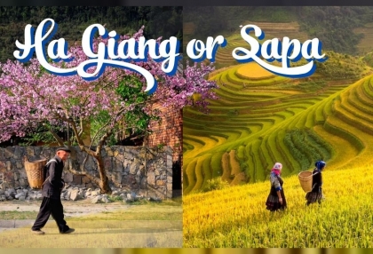
Ha Giang vs Sapa compares Hanoi transfers, itineraries of 2 to 4 days, landscapes, seasonal highlights and Beka's listed tour choices.
 Ha Giang
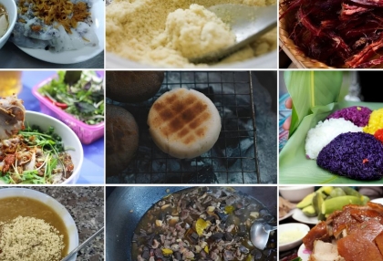
Ha Giang food from egg rice rolls to thang co, with market days, places to eat, vegetarian options, meal price references and food safety advice.
 Ha Giang
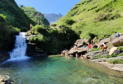
Ha Giang waterfall guide to five stops on and off the Loop, with Du Gia swimming advice, western detours, seasonal conditions and practical travel tips.
 Ha Giang
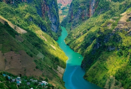
Plan a Nho Que River Ha Giang boat trip through Tu San Canyon with ticket prices, dock access, safety advice and the best months to see the green water.
 Ha Giang
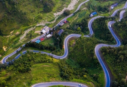
Ma Pi Leng Pass in Ha Giang: panorama viewpoints, the Ha Giang Skywalk, the Nho Que River view, how to get there, road safety and when to go.
 Ha Giang
Ha Giang loop packing list: what to pack, how to pack, riding gear, rain protection, documents and what to do with luggage.
 Ha Giang
Compare the Ha Giang loop and the Cao Bang loop by scenery, main stops, road difficulty, crowds and best season, with transport between the two and suggested routes for 2 to 8 days.
 Ha Giang
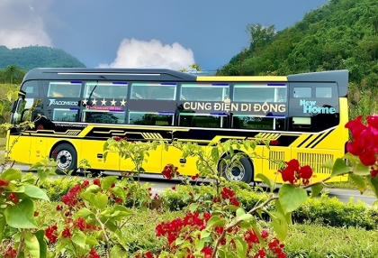
Plan your Ha Giang to Ninh Binh trip with bus options, travel time, distance, Hanoi connections, private car prices and practical tips.
 Ha Giang
Compare travel time and price for the bus, motorbike and private car routes from Ha Giang to Sapa, plus the exact distance and FAQs on the Ha Giang loop.
