
 Ha Giang
Ha Giang Loop Packing List: What to Pack for the Ride
Ha Giang loop packing list: what to pack, how to pack, riding gear, rain protection, documents and what to do with luggage.
Ma Pi Leng Pass is a mountain pass of about 20 km in Ha Giang, northern Vietnam, running between Dong Van and Meo Vac on National Highway 4C. It crosses the Dong Van Karst Plateau UNESCO Global Geopark at 1,200 to 1,500 meters, high above the Nho Que River.
| Quick facts | Details |
|---|---|
| Location | Between Dong Van and Meo Vac, Ha Giang (part of Tuyen Quang Province since July 2025) |
| Road | National Highway 4C (the Happiness Road) |
| Length | About 20 km |
| Elevation | Around 1,200-1,500 m |
| Built | 1959-1965 |
| Nearest towns | Dong Van and Meo Vac |
| Time needed | 1.5-2 hours with photo stops |
| Best months | October to April |
| Entrance fee | The pass is free. The boat trip and local motorbike taxis are paid separately |
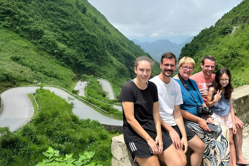
Ma Pi Leng is one of the best-known sections of the Ha Giang Loop. The pass follows a steep, narrow mountain between Dong Van and Meo Vac. Its name comes from the Hmong language and is commonly translated as "the bridge of a horse's nose".
The pass is located in the far north of Ha Giang, close to the border with China. Limestone cliffs rise on one side of the road. On the other side, the land drops into Tu San Canyon, where rock walls stand 700 to 800 meters above the river. The area was recognized as a national scenic site in 2009. It is part of the Dong Van Karst Plateau, which joined the Global Geoparks Network in 2010 and now holds the UNESCO Global Geopark title.
The pass is part of the Happiness Road, a 185 km route built between 1959 and March 1965. About 1,300 young volunteers and 1,000 local workers from 16 ethnic groups cut it almost entirely by hand. The cliff section at Ma Pi Leng was the hardest part. A small team worked on ropes hung from the rock face for nearly 11 months to open it. A monument to the volunteers now stands near the top.
The classic Ma Pi Leng panorama is seen from the main viewpoint near the top of the pass. From the platform, the view includes Tu San Canyon, the green water of the Nho Que, and the road cut into the opposite mountain. Light is best before 9:00 and in the late afternoon.
Next to the viewpoint is Ma Pi Leng Panorama, a rest stop with a cafe and a terrace built on the edge of the cliff. The terrace looks straight down the canyon, so many travelers stop here for a drink between Dong Van and Meo Vac.

The Ha Giang Skywalk is a narrow walking path cut into the white cliff above the main road. Local people once used it to reach their fields. Today it is a walking trail with open views of the canyon on one side.
From the pass, the Nho Que River is visible far below as a narrow green strip. A boat trip shows the same canyon from water level, where the cliffs of Tu San rise close on both sides. Life jackets are required on every boat.
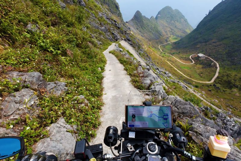
Ma Pi Leng Pass is reached by road from Dong Van or Meo Vac. Travelers coming from Ha Giang City usually spread the ride over 2 days and sleep in Yen Minh or Dong Van on the way.
| From | Distance to the main viewpoint | Travel time |
|---|---|---|
| Dong Van | About 12 km | 30 minutes |
| Meo Vac | About 10 km | 25 minutes |
| Ha Giang City | About 160 km | 5-6 hours of riding, usually split over 2 days |
Self-driving suits experienced riders who are used to mountain roads. Foreign visitors should carry their home motorcycle license and an International Driving Permit that covers motorcycles. The current rules, including the Ha Giang Loop permit, should be checked before the trip. An easy rider is a local driver who rides the bike while the guest sits behind, and this is the most popular choice for first-time visitors. A private car with a driver works well for families and older travelers.
Ma Pi Leng Pass is not dangerous for careful drivers in dry weather, but small mistakes can have serious results. The main risks are bends where drivers cannot see ahead, trucks and buses that cross into the other lane, and loose stones at the edges. Rain makes the surface slippery and can bring falling rocks. Fog can reduce visibility to a few meters.
First-time riders face a different risk, which is the view itself. The common mistakes are riding too fast and looking at the canyon instead of the road. Keep to the right, slow down before each bend, and stop only at wide stopping areas or marked viewpoints. In rain or fog, wait in Dong Van or Meo Vac until conditions improve. If you have never ridden a motorbike in the mountains, book a Ha Giang easy rider tour or a private car.
Ma Pi Leng Pass is always on the Dong Van to Meo Vac section of a Ha Giang Loop tour, but the day changes with the length of the trip. Beka Travel arranges tours of 2, 3, and 4 days with local partners and easy riders, from $135 per person.
Yes. Ma Pi Leng Pass is one of the most scenic and popular sections of the Ha Giang Loop. It is known for its wide views of Tu San Canyon and the Nho Que River.
Yes. Ma Pi Leng Pass can be visited without the full loop. Travelers can go from Ha Giang City to Dong Van or Meo Vac by bus, limousine van, or private car. From either town, a motorbike taxi, a rented motorbike, or a car can reach the pass in half a day.
Plan 1.5 to 2 hours to cross Ma Pi Leng Pass with stops at the main viewpoints. The Skywalk adds about 1 hour. The Nho Que River boat trip adds 2 to 3 hours, including the ride down to the dock and back.
The best time to visit Ma Pi Leng Pass is the dry season from October to April. Ha Giang weather is clearest in October and November, when buckwheat flowers bloom on the hillsides. From May to September, heavy rain increases the risk of landslides.
Yes. National Highway 4C is paved along the whole of Ma Pi Leng Pass and open to cars and minibuses. The Skywalk and the road down to the river are too narrow for cars. These two parts need a walk or a local motorbike taxi.
Ha Giang
Ha Giang loop packing list: what to pack, how to pack, riding gear, rain protection, documents and what to do with luggage.
 Ha Giang
Compare the Ha Giang loop and the Cao Bang loop by scenery, main stops, road difficulty, crowds and best season, with transport between the two and suggested routes for 2 to 8 days.
 Ha Giang
Plan your Ha Giang to Ninh Binh trip with bus options, travel time, distance, Hanoi connections, private car prices and practical tips.
 Ha Giang
Compare travel time and price for the bus, motorbike and private car routes from Ha Giang to Sapa, plus the exact distance and FAQs on the Ha Giang loop.
 Ha Giang
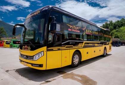
Hanoi to Ha Giang is about 300 to 320 km and takes 5 to 8 hours by road. The overnight sleeper bus costs about 250,000 to 300,000 VND and arrives before dawn.
 Ha Giang
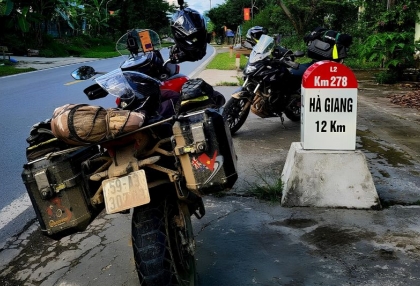
Ha Giang motorcycle rental guide: which bike to choose, daily prices, license and IDP rules, pre-ride checks and safety tips for riding the loop yourself.
 Ha Giang
Ha Giang loop permit 2026: official 10 USD fee, where to apply, who needs it, plus road safety, flood risks and travel insurance for the Ha Giang loop.
 Ha Giang
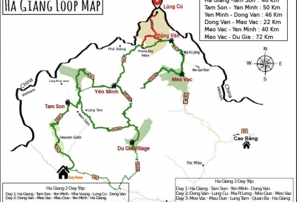
Discover the best Ha Giang attractions along the Loop, from Quan Ba and Yen Minh to Dong Van, Ma Pi Leng, Nho Que River and Du Gia.
 Ha Giang
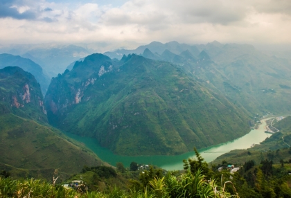
Explore Ha Giang, Vietnam with our travel guide covering the Ha Giang Loop map, attractions, 3 or 4 day itineraries, food, transport and travel tips.