



 Ha Giang
Lo Lo Chai Village: Culture, Homestays and How to Visit
Lo Lo Chai Village near Lung Cu Flag Tower, a UN Tourism Best Tourism Village 2025, with Lo Lo culture, earthen homestays and Ha Giang Loop access.
Ha Giang is one of the most spectacular mountain destinations in northern Vietnam, known for winding mountain roads, limestone peaks, deep valleys, ethnic villages and terraced rice fields. For many travelers, the best way to explore the region is a Ha Giang road trip along the famous Ha Giang Loop.
The route begins in Ha Giang City and gradually climbs toward Quan Ba, Yen Minh, Dong Van and Meo Vac before returning through Du Gia. Beyond the classic Loop, western Ha Giang offers another landscape of high mountains, cloud-covered peaks and terraced fields around Hoang Su Phi.
This guide follows the route geographically, making it easier to understand what to do in Ha Giang, what to see at each stage and how to combine the stops into a practical trip. The Ha Giang things to do listed below are arranged in the order travelers normally reach them.
| Attraction | From previous stop | Main experience | Suggested time |
|---|---|---|---|
| Milestone 0 | Ha Giang City | Start of the Loop | 15-30 minutes |
| March 26th Square | 200 m | City landmark | 20-30 minutes |
| Cam Mountain | 1.5 km | City views and short hike | 1 to 2 hours |
| Quan Ba Heaven Gate | 46 km | Mountain panorama | 30-60 minutes |
| Fairy Twin Mountains | Near Quan Ba | Scenic viewpoint | 15-30 minutes |
| Nam Dam Village | 6 km | Dao culture and homestay | 1 to 2 hours |
| Yen Minh Pine Forest | 45 km | Forest and mountain scenery | 30-60 minutes |
| Tham Ma Pass | 22 km | Winding mountain road | 20-30 minutes |
| Sung La Valley and Pao's House | 12 km | Valley and traditional house | About 1 hour |
| Vuong Family Mansion | 15 km | History and architecture | 45-60 minutes |
| Lung Cu Flag Tower | 26 km | Northern border viewpoint | 1 to 2 hours |
| Lo Lo Chai Village | 1.5 km | Lo Lo culture | 1 to 2 hours |
| Dong Van Old Quarter | 24 km | Historic town and food | 1 to 2 hours |
| Pho Bang Village | Side road from Sung La | Old clay and stone houses | 1 to 2 hours |
| Ma Pi Leng Pass | 10 km | Dramatic mountain views | 30-60 minutes |
| Ha Giang Skywalk | Near Ma Pi Leng | Cliff walking route | 2 to 3 hours |
| Tu San Canyon and Nho Que River | 7 km | Boat trip | 1 to 2 hours |
| Pa Vi H'mong Village | 4 km | H'mong culture and homestay | 1 to 2 hours |
| Du Gia Village | About 75 km | Waterfalls and village life | 1 day |
| Hoang Su Phi | West of the Loop | Rice terraces | 1 to 2 days |
| Tay Con Linh | West of Ha Giang | Mountain trekking | 1 to 2 days |
| Chieu Lau Thi | Hoang Su Phi area | Cloud hunting and hiking | 1 day |
The distances are approximate because the actual route depends on road conditions and the stops added along the way. The main attractions are arranged along the classic northeast route, while Hoang Su Phi, Tay Con Linh and Chieu Lau Thi form a separate western branch.
Ha Giang City is the natural gateway to the northern mountains and the starting point for most Loop itineraries. It sits beside the Lo River and has a relaxed atmosphere, local restaurants, cafes and several small sights that can fill half a day before or after a road trip.
Milestone 0 is the traditional starting point of the Ha Giang Loop. It is located in the center of Ha Giang City and is one of the first places travelers stop for photographs before beginning the mountain journey.
From here, the road gradually leaves the city and enters a landscape of hills, valleys and increasingly dramatic limestone mountains.
For travelers wondering where to start the Ha Giang Loop, Milestone 0 in Ha Giang City is the usual reference point.
March 26th Square, also known as Ha Giang City Central Square, is located near the Lo River. It is a simple place to walk around and observe local life.
The square becomes more lively on weekend evenings when the surrounding streets can become pedestrian-friendly and small food and drink stalls appear. There is little shade over the open paving, so the square is more comfortable in the early morning or late afternoon.
Cam Mountain, or Nui Cam, is a city viewpoint reached by a short uphill walk. The return climb takes around 45-60 minutes including time at the top. The route includes stone steps and some steeper sections.
From the top, visitors can see Ha Giang City surrounded by green mountains. There are also remains of an old French-era fort and a small pagoda along the way.
This is one of the easiest Ha Giang hiking experiences if you want to stretch your legs before starting a multi-day motorbike journey.
The road from Ha Giang City toward Quan Ba marks the beginning of the classic mountain scenery. Roads become more winding, valleys become deeper and limestone peaks start to dominate the landscape.
Quan Ba Heaven Gate is one of the most popular viewpoints on the Ha Giang Yen Minh section of the route. The road climbs through steep mountain terrain before reaching a viewpoint over the surrounding valleys and limestone peaks.
The attraction is especially useful as a first major stop because it gives travelers their first wide view of the karst landscape ahead.
Quan Ba Ha Giang is normally visited as a group of three stops: the Heaven Gate itself, the Twin Mountains below it and Nam Dam Village a short distance further on.
The Quan Ba Twin Mountains, also called Fairy Mountains, are two rounded peaks surrounded by rice fields and villages. They are located about 40 km from Ha Giang City and are visible from viewpoints along the road.
The mountains change appearance with the seasons, so the best time to visit Ha Giang decides what the valley looks like. Green fields, ripening rice and flowering plants create different views throughout the year. The surrounding area is also home to H'Mong, Dao and Tay communities.
Nam Dam is a community tourism village where travelers can learn more about local Dao culture and stay in traditional-style homestays.
A homestay here is more than simply a place to sleep. It can be an opportunity to eat home-cooked food, talk with local hosts and see how daily life continues in a mountain village.
The village is known for its local food and its ethnic minority homestays, which makes it a cultural stop rather than a photo stop.
The Yen Minh Pine Forest is located near Yen Minh and provides a change from the exposed limestone scenery of the karst plateau.
Tall pine trees cover rolling hills, creating a quieter landscape for photography, short walks and a break from riding. The forest is especially attractive around sunrise and sunset when light passes through the trees.
The surrounding Yen Minh Ha Giang area also includes rice terraces and small villages. The Lao Va Chai terraces near Yen Minh are worth a short detour for travelers interested in mountain farming landscapes.
The road from Yen Minh to Dong Van enters some of the most recognizable scenery on the Ha Giang Loop. Mountain passes, flower-filled valleys, old houses and historic sites appear along the route.
Tham Ma Pass is a winding mountain road between Yen Minh and Dong Van. The road curves through steep hills and is often photographed from viewpoints above the pass.
The pass is not only about the road itself. It is part of the experience of crossing the Dong Van Karst Plateau, where limestone mountains and narrow valleys surround the route.
Stop at safe viewpoints rather than stopping in the middle of the road, particularly when traffic is approaching from blind bends.
Sung La Valley is one of the most scenic valleys in the Dong Van area. The valley combines mountains, fields, traditional houses and small ethnic villages.
It is particularly attractive during the buckwheat flower season in October and November. The valley can be explored on foot or by bicycle, which gives more time to observe local farming and village life.
Pao's House, the traditional H'Mong home associated with the Vietnamese film The Story of Pao, stands in the same valley. Visitors can see the stone walls, courtyard and traditional architecture that characterize this part of northern Vietnam.
The Vuong Family Mansion, often called the H'Mong King's Palace, is located in Sa Phin Valley.
Built in the early 20th century, the complex combines H'Mong, Chinese and French architectural influences. It provides an insight into the history of the Vuong family and the social structure of the H'Mong community in the region.
Allow some time to walk through the courtyards and buildings rather than viewing the mansion only from the outside.
Lung Cu Flag Tower is one of the most important landmarks in northern Vietnam. Located near the Chinese border, it is commonly associated with the northernmost area of Vietnam.
The tower sits on a mountain above the surrounding villages and fields. Reaching the viewing area involves a long staircase, and the view opens up further with each section climbed.
From the top, the surrounding rugged mountains, valleys and small settlements along the border area come into view.
Because Lung Cu requires a detour from the main Dong Van to Meo Vac road, it fits more comfortably into a Loop spread over 4 days than into a tightly planned 3 days.
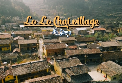
Lo Lo Chai is a small cultural village near Lung Cu, home to the Lo Lo ethnic community.
The village is known for traditional houses, local clothing and a peaceful rural setting. Walking through the village provides a slower experience after the long mountain roads.
Among the cultural Ha Giang places to visit, Lo Lo Chai rewards travelers who take time to observe the village rather than simply stopping for photographs.
Dong Van Old Quarter is one of the main cultural stops on the Loop. Traditional houses line the small streets, creating a strong contrast with the surrounding limestone mountains.
H'Mong, Tay and Hoa cultural influences can all be seen in the architecture and in the local markets. The nearby Dong Van Sunday Market is an important gathering place for people from surrounding villages, and smaller evening stalls operate in the old quarter itself.
If you stay overnight, walk around the old quarter in the evening and return in the morning when the streets are quieter.
Pho Bang is a small village hidden among the mountains near the Chinese border. Its old clay and stone houses give it a distinctive appearance.
The village is home to H'Mong and Hoa communities. Depending on the season, visitors may see peach blossoms, canola flowers or buckwheat flowers around the surrounding hills.
The road to Pho Bang is less straightforward than the main Loop, so it is better suited to travelers who have enough time for side trips.
The section between Dong Van and Meo Vac is often considered the dramatic heart of the Loop. Here, the road climbs across Ma Pi Leng Pass and looks down toward the Nho Que River and Tu San Canyon.
Ma Pi Leng Pass is one of the most famous Ha Giang attractions and a highlight of almost every Loop itinerary.
The road follows the steep mountainside between Dong Van and Meo Vac, with sharp bends, exposed cliffs and wide views across the karst landscape. The pass is roughly 20 km long, with the Nho Que River far below.
The best way to experience Ma Pi Leng is to slow down at designated viewpoints and walk short sections of the road or trail. Riders on a Ha Giang motorbike tour usually stop at every viewpoint rather than pushing straight through.
The Ha Giang Skywalk is a narrow cliff-side walking route near Ma Pi Leng Pass, usually reached from the main viewpoint area. It gives travelers a closer view of the cliffs and valleys than riding along the main road.
For a more active experience, park safely and walk part of the route. The path toward the White Cliff area opens onto panoramic views over the Nho Que River and the surrounding mountains, and the walk is around 2 km each way depending on the section visited.
Bring water and wear proper shoes, especially if you plan to combine the Skywalk with other short hikes.
Tu San Canyon is a deep, narrow valley carved through the limestone mountains by the Nho Que River. The river appears emerald green from many viewpoints above the canyon.
A boat trip on the Nho Que River runs between the high cliffs and shows the landscape from below. Kayaking is also available depending on local operating conditions, and the two options give quite different views of the same vertical walls.
For many travelers, the combination of Ma Pi Leng Pass from above and the Nho Que River from below provides two completely different views of the same landscape.
Pa Vi H'mong Community Village is located near Meo Vac and is designed around traditional H'Mong-style houses.
The village is a useful cultural stop where travelers can learn more about H'Mong architecture, handicrafts, food and community-based tourism. It can also be a convenient place to experience a homestay and local meals.
This type of community experience adds another dimension to the Ha Giang road trip, showing that the region is not only about mountain roads and viewpoints.
Du Gia is located on the return section of the Loop between Meo Vac and Ha Giang City. Compared with Dong Van and Ma Pi Leng, the landscape here feels greener and more relaxed.
The area is known for small villages, rice fields, mountain roads and homestays. It is a good place to slow down after several days of riding through the higher karst plateau.
Local markets are also part of the experience. Du Gia holds its weekly market on Saturday, while the Dong Van and Meo Vac markets are usually held on Sunday.
If you have enough time, spend a night in Du Gia rather than rushing directly back to Ha Giang City.
The western part of the former Ha Giang region offers a very different landscape from the classic Loop. Instead of the sharp limestone scenery around Dong Van, Hoang Su Phi is known for steep green mountains, narrow valleys and large terraced rice fields.
This area is better suited to travelers who want trekking, photography and slower rural travel.
Hoang Su Phi is one of the best places in northern Vietnam to see large-scale terraced rice fields.
Terraced fields are farmed across around 24 communes in the wider area. The terraces in 11 of those communes were ranked as a national landscape in 2012 and 2016, among them Ban Phung, Ban Luoc, San Sa Ho, Ho Thau, Nam Ty and Thong Nguyen.
The scenery changes with the farming season. From April to June, water-filled terraces can reflect the sky and surrounding mountains. Around September and October, the fields turn golden as the rice ripens.
Hoang Su Phi is therefore a strong alternative for travelers whose main interest is rice terraces rather than the classic Ha Giang Loop.
Tay Con Linh is the highest mountain in the western Ha Giang region at around 2,427 m, and it is widely described as the highest peak in northeast Vietnam. The surrounding area includes forests, steep valleys and remote ethnic villages.
Trekking here requires more preparation than a normal sightseeing stop on the Loop. Weather can change quickly at higher elevations, and local guides are useful on unfamiliar trails.
Tay Con Linh is one of the peaks travelers commonly combine with trekking and cloud hunting in the Hoang Su Phi area.
Chieu Lau Thi is another high mountain destination in Hoang Su Phi and is particularly known for cloud views. The summit stands at around 2,402 m.
The peak is located in Ho Thau Commune, around 42 km from the main Hoang Su Phi town area. Early mornings are usually the best time to look for layers of cloud below the mountain.
For travelers planning Ha Giang hiking rather than a motorbike-focused trip, Chieu Lau Thi and Tay Con Linh are the two most rewarding options in the region.
The main things to do in Ha Giang include riding the Ha Giang Loop, crossing Ma Pi Leng Pass, visiting the Dong Van Karst Plateau, taking a boat on the Nho Que River, visiting Lung Cu Flag Tower and exploring ethnic villages.
The most popular experiences combine scenery and local culture: a Ha Giang road trip, mountain viewpoints, short hikes, boat trips, local markets, traditional villages and homestays.
The best-known Ha Giang attractions include Quan Ba Heaven Gate, Quan Ba Twin Mountains, Dong Van Old Quarter, Sung La Valley, Vuong Family Mansion, Lung Cu Flag Tower, Ma Pi Leng Pass, Tu San Canyon and the Nho Que River.
For a first trip, focus on Quan Ba, Yen Minh, Dong Van, Lung Cu, Ma Pi Leng, Meo Vac and Du Gia. If you have additional time, add Hoang Su Phi for terraced rice fields and trekking.
Ma Pi Leng and the Ha Giang Skywalk are suitable for short walks with mountain views. Hoang Su Phi, Tay Con Linh and Chieu Lau Thi are better options for travelers looking for longer trekking experiences.
For Ha Giang City things to do, visit March 26th Square, climb Cam Mountain, explore the Provincial Museum, walk along the Lo River and try local food before or after the Loop. Allowing half a day in the city is more rewarding than leaving immediately for the mountains.
3 days can cover the main loop, which is what a 3 day Ha Giang loop tour follows. 4 days gives you more time for Lung Cu, villages, viewpoints and weather delays. Add additional days for Hoang Su Phi or longer hikes.
No. The Loop is the region's best-known road trip, but Ha Giang also offers cultural villages, local markets, hiking, terraced rice fields and mountain peaks. Hoang Su Phi in particular provides a very different travel experience from the classic Dong Van to Meo Vac route.
Ready to ride: see our best Ha Giang loop tour options!
Ha Giang
Lo Lo Chai Village near Lung Cu Flag Tower, a UN Tourism Best Tourism Village 2025, with Lo Lo culture, earthen homestays and Ha Giang Loop access.
 Ha Giang
Ha Giang vs Sapa compares Hanoi transfers, itineraries of 2 to 4 days, landscapes, seasonal highlights and Beka's listed tour choices.
 Ha Giang
Ha Giang food from egg rice rolls to thang co, with market days, places to eat, vegetarian options, meal price references and food safety advice.
 Ha Giang
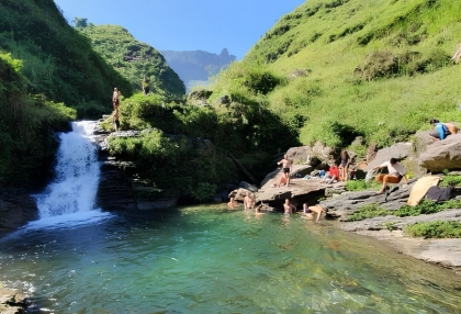
Ha Giang waterfall guide to five stops on and off the Loop, with Du Gia swimming advice, western detours, seasonal conditions and practical travel tips.
 Ha Giang
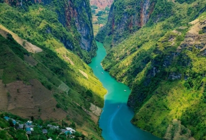
Plan a Nho Que River Ha Giang boat trip through Tu San Canyon with ticket prices, dock access, safety advice and the best months to see the green water.
 Ha Giang
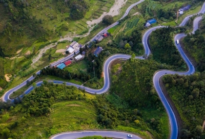
Ma Pi Leng Pass in Ha Giang: panorama viewpoints, the Ha Giang Skywalk, the Nho Que River view, how to get there, road safety and when to go.
 Ha Giang
Ha Giang loop packing list: what to pack, how to pack, riding gear, rain protection, documents and what to do with luggage.
 Ha Giang
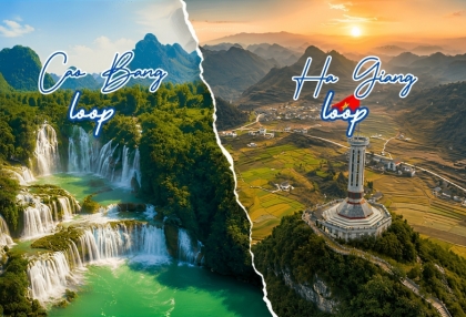
Compare the Ha Giang loop and the Cao Bang loop by scenery, main stops, road difficulty, crowds and best season, with transport between the two and suggested routes for 2 to 8 days.
 Ha Giang
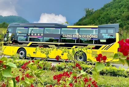
Plan your Ha Giang to Ninh Binh trip with bus options, travel time, distance, Hanoi connections, private car prices and practical tips.
 Ha Giang
Compare travel time and price for the bus, motorbike and private car routes from Ha Giang to Sapa, plus the exact distance and FAQs on the Ha Giang loop.
