



 Ha Giang
Nho Que River Ha Giang: Boat Trip, Tu San Canyon and Tips
Plan a Nho Que River Ha Giang boat trip through Tu San Canyon with ticket prices, dock access, safety advice and the best months to see the green water.
The five Ha Giang waterfall stops in this article are Du Gia, Tien at Deo Gio, Luong, Nam Tau and Nai near Nam Dam. Du Gia and Nam Dam fit the main Loop route; the others suit longer detours. Choose the stops that match the route when planning a Ha Giang Loop tour.
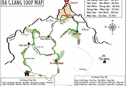
The Ha Giang Loop map helps connect waterfall visits with mountain passes and village stays. Du Gia suits a pause beside the pool, Nam Dam combines a forest walk with Dao village life, and the western falls add time away from the main circuit.
| Waterfall | Main feature | Current commune | Route fit | Best for |
|---|---|---|---|---|
| Du Gia | Pool below Ba Tien Waterfall | Du Gia | Loop routes through Du Gia | Poolside break; swimming when permitted |
| Tien at Deo Gio | National scenic site in forest | Nam Dan | Western extension | Forest scenery and waterfall viewing |
| Luong | 11 tiers over nearly 1 km | Khuon Lung | Western extension | Cascade views and photography |
| Nam Tau | Three tiers of about 15-20 m each | Lien Hiep | Separate southern detour | Forest scenery and nearby caves |
| Nai near Nam Dam | Forest waterfall near a Dao village | Quan Ba | Optional northern Loop detour | Walking and a village stay |
Ha Giang became part of Tuyen Quang Province in July 2025. Former district names appear below to help match older maps and travel guides; the commune names reflect the administrative changes.
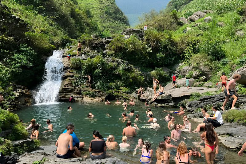
Du Gia Waterfall is a convenient stop on routes through Du Gia village. Also called Ba Tien Waterfall, it is located in Du Gia commune, formerly in Yen Minh district. The pool and nearby village accommodation suit a break and an overnight stay. Du Gia is one of the Ha Giang attractions on the road between Meo Vac and Ha Giang city.
Ask the homestay or local guide for the current parking location and walking approach. Leave enough time for the walk, drying off after a permitted swim, and the return before dark. A waterfall visit works best when it fits the day's overnight stop.
A drowning on July 12, 2023, led to a temporary swimming ban. Swimming had resumed by March 2024. Follow the checks in the Tips section before entering the pool, and skip cliff jumping. Submerged rocks, depth changes and currents can be difficult to judge from the surface; viewing from the bank is another way to enjoy the falls.
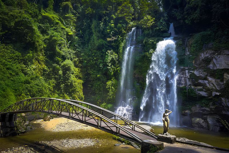
Tien Waterfall at Deo Gio is a forest destination in western Ha Giang. It is located in Nam Dan commune, formerly in Xin Man district, and received national scenic recognition on November 16, 2009. The waterfall lies within a forest area of about 3,947 hectares at roughly 1,315 m elevation. For navigation, use Tien Waterfall at Deo Gio in Nam Dan as the destination name.
Tien suits a longer journey through the western mountains, with time to walk and view the falls. An overnight stay in the area gives the stop room in the itinerary and reduces the need to retrace mountain roads after dark. Plan the journey separately from the Dong Van and Meo Vac circuit, using the access and parking advice from local accommodation. The forest setting is the main reason to make this detour.
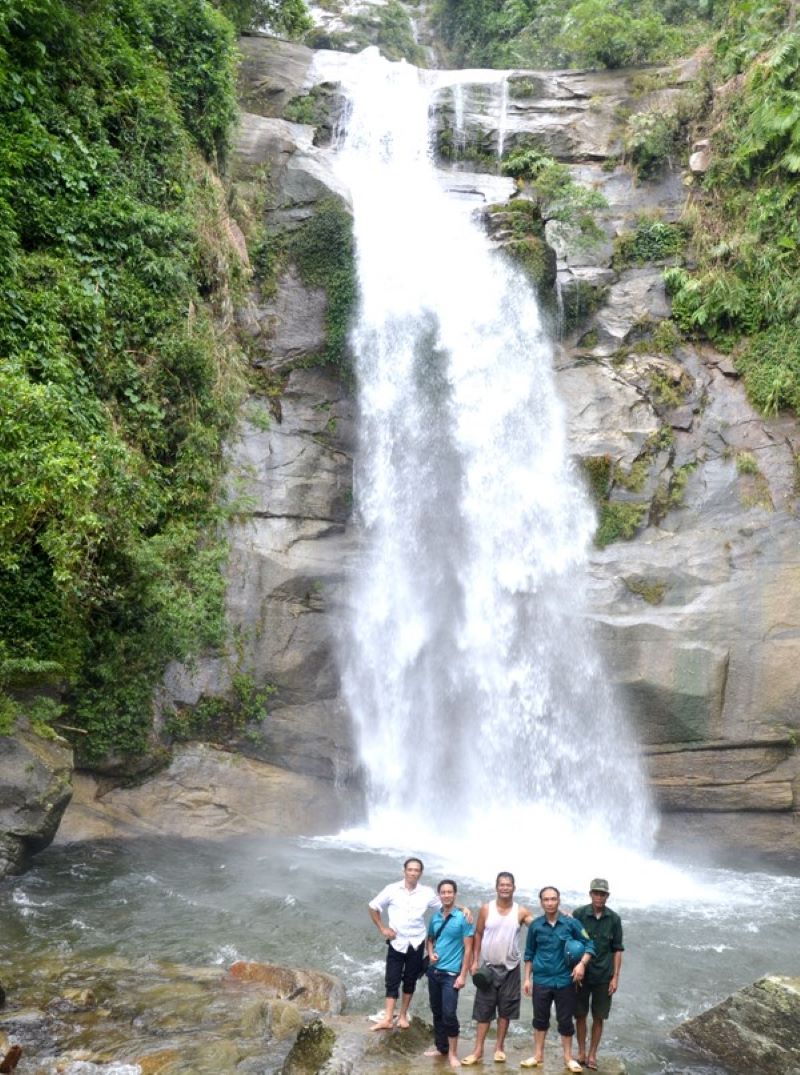
Luong Waterfall stretches through 11 tiers along a cascade nearly 1 km long. This is the length along the slope, not the vertical height. Its third tier drops nearly 20 m, with natural pools between the cascades. The waterfall is located at Ban Bo in Khuon Lung commune, formerly Na Chi commune in Xin Man district.
The succession of tiers makes Luong a choice for cascade views and photography. Allow time to enjoy the viewpoints reached by the usable path, keeping the walk within daylight hours. A local guide can help choose an approach suited to the day's conditions. Luong fits a western extension with an overnight stay nearby, and it pairs with Tien when the road connection and riding time are built into the itinerary.
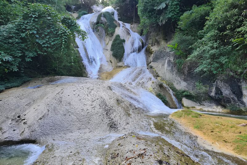
Nam Tau Waterfall has three forest tiers dropping around 15-20 m each. It is located in Lien Hiep commune, formerly Duc Xuan commune in Bac Quang district. The waterfall is about 50 km east of the former Bac Quang district center, with Na Can caves nearby in the forest.
The combination of cascades and forest scenery suits a viewing visit. A local guide can help plan the approach and a possible cave visit under the day's conditions. Give the walk enough time rather than using the waterfall as a brief break between long riding sections.
Nam Tau belongs in a separate southern detour, with accommodation chosen around that route. It offers a different focus from the high passes around Dong Van and Meo Vac. Travelers with more days in northern Vietnam can add it as a separate stop in the southern valleys.
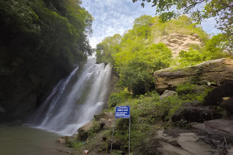
Nai Waterfall near Nam Dam combines a forest walk with time in a Dao village. Nam Dam is located in Quan Ba commune, formerly in Quan Ba district. Village homestays provide a base for exploring the area, and a host can help arrange a walk to the waterfall with someone who knows the trail.
Nam Dam suits the northern opening section of a Loop, with the exact day depending on the route and overnight stops. Leave time for both the waterfall approach and the village. After rain, allow extra walking time for slippery footing. A village stay is a useful alternative if the weather changes the walking plan, and gives the stop more room than a brief roadside visit.
May to September generally brings more rain and fuller waterfalls, while October to April is usually drier. Ha Giang weather follows the same pattern, with heavier summer rain and cooler winter conditions. Strong flow can improve a waterfall photograph while making the pool, approach and access road less suitable for a visit.
For walking and viewing, a dry spell and usable trail matter more than maximum water volume. For swimming, local permission and conditions on the day matter more than a seasonal label. Smaller cascades may be thinner in dry periods, and winter can make getting wet uncomfortable. Heavy rain upstream also matters when the sky at the waterfall is clear. Keep an alternative village or viewpoint stop if the approach is unsuitable.
Before you go, confirm access, swimming permission, water conditions and available supervision with your host or local guide. Follow closures and barriers, skip cliff jumping, and choose a viewing stop if swimming conditions are unsuitable. Visit in daylight, ask when groups usually arrive, and leave enough time for the walk back and onward ride.
Carry small cash for parking or local charges, and check the amount on arrival. Wear shoes with good grip on wet paths and rock. If swimming is permitted, wear suitable clothing underneath and bring a towel. Ask ahead about changing space and toilets. The Ha Giang Loop packing list covers other items for the mountain ride.
Use a dry bag for your phone and keep belongings clear of the water. Avoid climbing wet cascade faces, and use a local guide for an unfamiliar walking approach.
Beka arranges Ha Giang trips with local partners. Itineraries of 2 days, 3 days and 4 days start from $135, $175 and $205 per person respectively. The date and package determine the final booking quote. A Ha Giang easy rider tour pairs the mountain route with a local driver and can include a planned waterfall stop.
Du Gia appears in the published itineraries of 3 days and 4 days. Before booking a 3 day Ha Giang loop tour, confirm the day of the waterfall visit and the alternative if access is restricted. Tien, Luong and Nam Tau are options for a separate route discussion with more time in the western or southern area.
Yes, when local rules allow it and water conditions are suitable. Swimming resumed after the temporary July 2023 ban, but permission should be checked again before a visit. Follow the checks in the Tips section, stay out when conditions are unsuitable, and skip cliff jumping from the surrounding rocks.
There is no single ticket covering all five waterfalls; parking or entry charges may apply at individual stops. Ask about admission, parking and guiding separately before arrival. Carry small cash and agree on any charge before using the service. A homestay or local guide can clarify the arrangements before departure.
Yes, a motorbike can cover the road approach, followed by a walk where needed. Confirm the parking point and road condition, and choose a local driver if mountain riding is unfamiliar. For independent riding, compare the options for Ha Giang motorcycle rental and check the licensing rules before setting off.
An itinerary of 3 days or 4 days can accommodate Du Gia on suitable routes, with Nam Dam as an optional village detour. Tien and Luong need a western extension, while Nam Tau needs a separate southern route. Choose the overnight stops first, then allow time for the waterfall approaches.
No. Ban Gioc is in Cao Bang, a separate destination from the waterfalls listed here. It belongs in a Cao Bang itinerary or a longer northern Vietnam trip. Ha Giang Loop vs Cao Bang Loop comes down to mountain passes versus a route that includes Ban Gioc.
Ha Giang
Plan a Nho Que River Ha Giang boat trip through Tu San Canyon with ticket prices, dock access, safety advice and the best months to see the green water.
 Ha Giang
Ma Pi Leng Pass in Ha Giang: panorama viewpoints, the Ha Giang Skywalk, the Nho Que River view, how to get there, road safety and when to go.
 Ha Giang
Ha Giang loop packing list: what to pack, how to pack, riding gear, rain protection, documents and what to do with luggage.
 Ha Giang
Compare the Ha Giang loop and the Cao Bang loop by scenery, main stops, road difficulty, crowds and best season, with transport between the two and suggested routes for 2 to 8 days.
 Ha Giang
Plan your Ha Giang to Ninh Binh trip with bus options, travel time, distance, Hanoi connections, private car prices and practical tips.
 Ha Giang
Compare travel time and price for the bus, motorbike and private car routes from Ha Giang to Sapa, plus the exact distance and FAQs on the Ha Giang loop.
 Ha Giang
Hanoi to Ha Giang is about 300 to 320 km and takes 5 to 8 hours by road. The overnight sleeper bus costs about 250,000 to 300,000 VND and arrives before dawn.
 Ha Giang
Ha Giang motorcycle rental guide: which bike to choose, daily prices, license and IDP rules, pre-ride checks and safety tips for riding the loop yourself.
 Ha Giang
Ha Giang loop permit 2026: official 10 USD fee, where to apply, who needs it, plus road safety, flood risks and travel insurance for the Ha Giang loop.
 Ha Giang
Discover the best Ha Giang attractions along the Loop, from Quan Ba and Yen Minh to Dong Van, Ma Pi Leng, Nho Que River and Du Gia.
