
Bai Tho Mountain, or Poem Mountain, is the limestone peak that rises straight out of the middle of Ha Long City, 168 meters above the streets and the water. It is named after a poem a Vietnamese king had carved into its cliff in 1468. The climb has been officially closed since November 2017, so this Bai Tho Mountain Halong Bay guide covers the history, the current access rules and what visitors can still see around its base.
Bai Tho Mountain Halong Bay overview
Bai Tho Mountain is a historic limestone peak in the center of Ha Long City, known for the royal poems carved into its cliff, its use as a military lookout and its position directly above the bay. The Vietnamese name Nui Bai Tho translates as Poem Mountain.
| Quick fact | Details |
|---|---|
| Location | Bach Dang Ward, central Ha Long City, Quang Ninh Province |
| Height | 168 meters |
| Former name | Truyen Dang Son, the mountain that passes on the light |
| First poem | King Le Thanh Tong, 1468 |
| Second poem | Lord Trinh Cuong, 1729 |
| Climbing status | Closed since November 2017, no confirmed reopening date |
| Nearby sites | Long Tien Pagoda, Duc Ong Temple |
History and the origin of the name
The mountain was called Truyen Dang Son long before it had a poem on it. The name means the mountain that passes on the light, and it describes what the peak was used for: guards at the top lit fires to warn the capital that enemy ships had entered the coastal waters.
The present name dates from 1468, when King Le Thanh Tong stopped here on a boat trip through the bay, wrote a poem praising the scenery and had it carved into the southern cliff. Lord Trinh Cuong read that poem in 1729 and had a second one carved nearby, which is how Bai Tho Poem Mountain came to hold poems from two royal courts more than 250 years apart.
Location of Bai Tho Mountain
The mountain is located in Bach Dang Ward, in the old center of Ha Long City on the Hon Gai side, with the former climbing entrance on Hang Noi Street. It is close enough to the water that boats leaving the bay pass directly beneath it.
That central position is what makes the site easy to include in a city itinerary even with the summit closed. The cultural sites at the foot of the mountain are within walking distance of each other, and the restaurants and markets of Hon Gai are a few streets away.
Current access status

Anyone searching for Bai Tho Mountain closed will find the same answer in 2026: the climb is not open. Quang Ninh authorities shut the route in November 2017 after a forest fire on the mountain caused landslides, locking the main gate and fencing the entrance.
Things to do at Bai Tho Mountain
The peak of Bai Tho Mountain

The Bai Tho Mountain hike was for years one of the most popular free viewpoints in Ha Long, with a flagpole at the top and a clear view across the karst islands, the harbor and the city. Older blogs still describe the route in detail, which is why the closure catches so many travelers by surprise.
Until the route reopens with official supervision, the mountain is something to look at rather than climb. It photographs well from the Hon Gai waterfront, from the bridge and from the deck of a boat leaving the bay, and these angles show how steep the cliff is.
Visiting Long Tien Pagoda
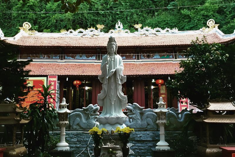
Long Tien Pagoda is located at the foot of the mountain and is the largest pagoda in Ha Long City. Its courtyard, curved roofs and altars are a quiet contrast with the cruise terminals and beaches a few kilometers west.
The pagoda is busiest during the lunar new year and on festival days, when local families come to make offerings. Visitors are welcome outside those periods too, as long as they dress modestly and keep noise down inside the halls.
Worshipping at Duc Ong Temple
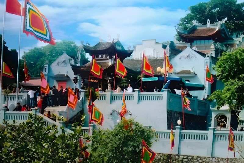
Duc Ong Temple, also called Tran Quoc Nghien Temple, is located nearby and honors Tran Quoc Nghien, a general of the Tran dynasty and a son of Tran Hung Dao. The temple links this area to the coastal defense history that gave the mountain its original signal-fire role.
The temple is small and takes only a short visit, but seeing it together with the pagoda and the carved cliff shows more clearly why this corner of Ha Long City was important long before the first cruise boat arrived.
How to get to Bai Tho Mountain
Travelers asking how to get to Bai Tho Mountain should aim for Bach Dang Ward on the Hon Gai side of Ha Long City. From the hotels and marina around Bai Chay it is a short taxi or Grab ride across Bai Chay Bridge, usually 10 to 15 minutes depending on traffic. Our guide to Bai Chay covers that side of the city.
From the capital, the road journey takes around 2.5 to 3 hours by limousine bus, private car or shuttle, and the options are set out in our Hanoi to Halong Bay guide. Reaching the base of the mountain is easy. Reaching the top is a different matter, and there is currently no authorized route up.
The view from the top depends on the haze, which is thickest in late winter and clearest in autumn. Check the weather in Halong Bay before planning a climb for the view.
Frequently asked questions
Is Bai Tho Mountain open to tourists?
No. The climb has been officially closed since November 2017 and remains closed in 2026. The base of the mountain and the cultural sites around it are open as normal.
Can I do the Bai Tho Mountain hike?
No. The route has been closed since November 2017 and there is no official climbing path in 2026. The slopes became unstable after the fire, so the gate stays locked and the entrance stays fenced.
Why is Bai Tho Mountain called Poem Mountain?
Because King Le Thanh Tong had a poem carved into its cliff in 1468 after stopping here on a boat trip through the bay. Lord Trinh Cuong added a second poem in 1729.
How high is Bai Tho Mountain?
168 meters above sea level. The cliff face is almost vertical, which is why the mountain can be seen from most of the old city center and from boats leaving the bay.
Can I see Bai Tho Mountain from a Halong Bay cruise?
Yes. The mountain is right beside the entrance to the bay, so boats pass close to it on the way out. Cruises running from the city are listed with the Halong Bay cruises.
What can I visit near Bai Tho Mountain?
Long Tien Pagoda and Duc Ong Temple are located at the foot of the mountain, and the Hon Gai market and waterfront are a short walk away. The rest of the area is covered in our Halong Bay travel guide.
Will Bai Tho Mountain reopen?
Quang Ninh has discussed reopening it as a cultural and spiritual site with a supervised route, but no date has been confirmed. Check the latest announcements from the province before planning a climb, and see bekatravel.com for cruises running now.